
The Industry's First
Autonomous Field Planning Agent
Plan Smarter.
Drill Deeper.
The Future of Field Development is Here.
EzFieldPlan merges subsurface modeling, AI-driven automation, and Monte Carlo economic simulations into one dynamic platform. Stop guessing and start optimizing your well trajectories and field boundaries in seconds with your dedicated engineering agent.
Escape the Gridlock of Static Planning
Traditional field development relies on disconnected tools, static maps, and manual iterations. This fragmented approach leads to compounding errors, overlooked risks, and massive delays between geologic analysis and drill-ready plans.
Enter the unified command center. EzFieldPlan synchronizes mapping with real-time analysis. Every adjustment you make to a trajectory or boundary instantly updates across all views and economic models, guided by your AI assistant.
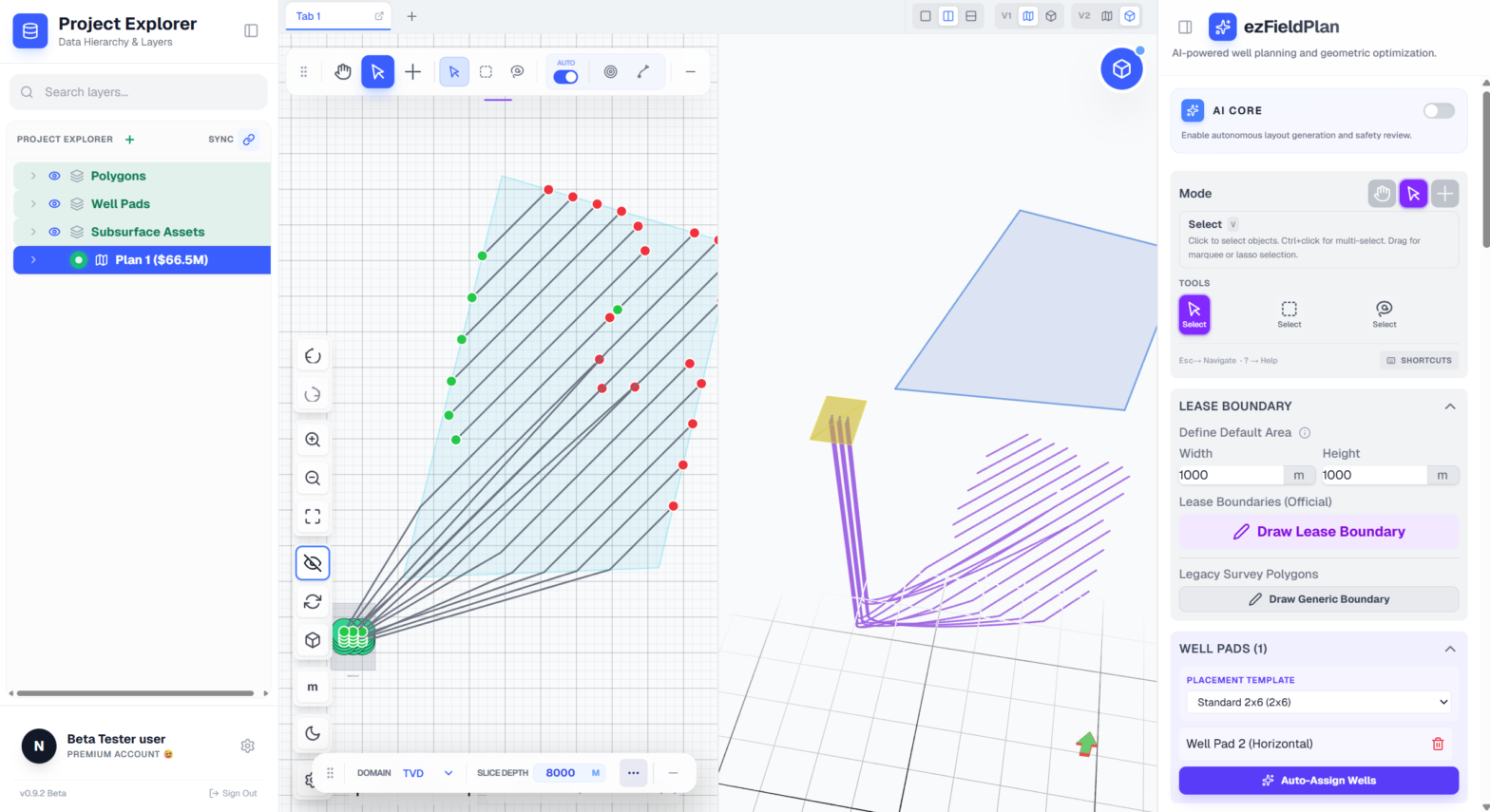
Meet Your AI Field Planning Agent
Your Persistent, Context-Aware Engineering Partner.
Parameter Suggestions
AI analyzes boundaries and basin data to suggest optimal well spacing, lengths, and orientations.
Automated Plan Review
Instantly check your design against DLS limits, proximity violations, and mapped hazards.
Natural Language Commands
Execute intent like "Create a 6-well pad" through chat with instant visualization.
Precision Engineering Evolution
High-density data environments designed for complex field architecture, powered by human-AI collaboration.
Dynamic Multi-Scenario Workspace
Utilize linked views and smart digitizing tools to instantly iterate on complex well pads. Compare multiple development scenarios side-by-side without duplicating projects.
AI Field Planning Agent
Leverage machine learning for intelligent parameter suggestions. The agent autonomously reviews plans against structural constraints and alerts you to potential collisions or sub-optimal trajectories.
Advanced Subsurface Modeling
Import and manipulate complex geological surfaces. Seamlessly toggle between TVD, TVDSS, and TWT domains while maintaining absolute precision across all depth references.
Economic Risk Engine
Run thousands of Monte Carlo simulations in the background. Visualize P10/P50/P90 outcomes instantly via integrated Tornado charts to quantify risk before capital deployment.
Ready to Transform Your Field Development?
Join leading engineering teams utilizing EzFieldPlan's AI-assisted workflows to reduce planning cycle times by up to 60% while dramatically improving trajectory precision.